
A tropical storm warning has been issued for North Carolina as Hurricane Erin churns up the east coast of the U.S. as a Category 2 storm.
The National Hurricane Center said Wednesday morning that the storm was about 400 miles south-southeast of Cape Hatteras, North Carolina. A state of emergency has been declared for the entire state as the storm had maximum sustained winds of 100 mph and was moving north-northwest at 13 mph, the hurricane center said in its 8 a.m. EDT update.
Erin is already a large hurricane, with winds extending outward up to 90 miles from the center and tropical-storm-force winds extending outward up to 265 miles from the center. It is expected to remain a hurricane this week while growing in size as it continues its trek across the Atlantic and eventually turns out to sea.
The storm is expected to take a turn north-northeast on Wednesday and move over the western Atlantic Ocean between the east coast of the U.S. and Bermuda, before passing south of Atlantic Canada into the weekend, the hurricane center said.
Erin will make its closest pass to the U.S. on Thursday, when the onshore winds will be strongest, leading to coastal flood concerns and dangerous rip currents. The heavy rain will remain offshore so that the strong winds will be the most noticeable impact.
Erin could strengthen on Wednesday and Thursday but is expected to begin weakening by Friday, the hurricane center said.
The 8 a.m. advisory from the National Hurricane Center added that the tropical storm warning for North Carolina includes the border of the state with Virginia. Storm surge warnings are also in place for the state.
From Cape Lookout to Duck, North Carolina, 2 to 4 feet of storm surge flooding is possible along the coast, according to the hurricane center. Additionally, 1 to 2 inches of rain could hit the Outer Banks on Wednesday and Thursday.
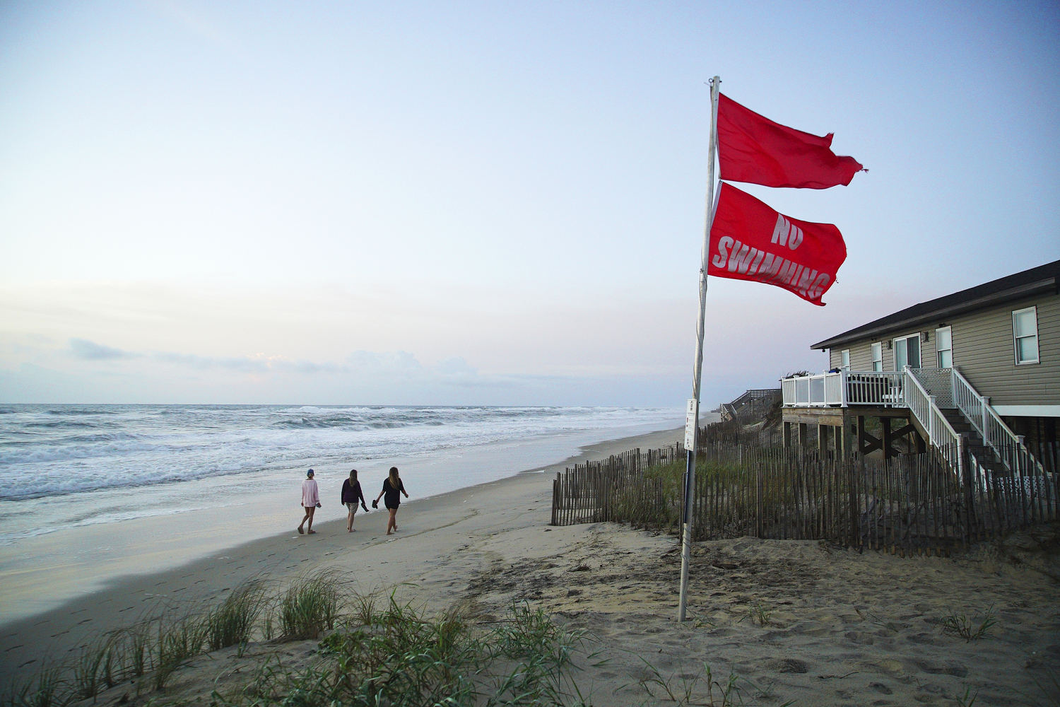
“Weather conditions expected to deteriorate along the coast of North Carolina by this evening,” the hurricane center said. “Beachgoers are cautioned against swimming at most U.S. East Coast beaches due to life-threatening rip currents.”
Video from North Carolina shows major waves rolling onto land, flooding roads and beachfront homes.
Swells caused by the hurricane will affect the Bahamas, Bermuda, and the east coast of the U.S. over the next several days, with rough oceans expected to produce life-threatening surf and rip currents, the hurricane center said.
The National Weather Service in Jacksonville, Florida, also warned of dangerous surf conditions and rip tides on Wednesday.
“Dangerous Marine & Surf Conditions worsen today as waves & winds increase. Deadly rip currents, high surf & minor tidal flooding around high tide this evening at the coast,” the NWS said on X. “Stay out of the ocean!”
Other states this week have similarly issued warnings to stay out of the ocean, including in New Jersey and New York, as beaches in North Carolina already reported several rip current rescues on Tuesday.
“We are hyper, hyper concerned, first and foremost about complacency, particularly when the weather is really good Thursday afternoon through Sunday, in terms of people sort of thinking about going in the water because these rip currents are brutal,” New Jersey Gov. Phil Murphy said at a news conference Tuesday afternoon. “Please, don’t go into the water.”
New York Gov. Kathy Hochul on Tuesday prohibited swimming at Long Island beaches because of the swells that are expected in the area. Swimming at New York City beaches is also barred on Wednesday and Thursday.
Coastal towns such as Wrightsville Beach, North Carolina, Rehoboth Beach, Delaware, and Wildwood, New Jersey, have issued no-swimming advisories for the week.
Rip currents were observed on Tuesday, the National Weather Service in Wilmington said on X. The agency warned of “dangerous rips & rough surf” that will continue through Friday.